[ad_1]
Newswise – Campaign data will help improve the accuracy of weather and climate models.
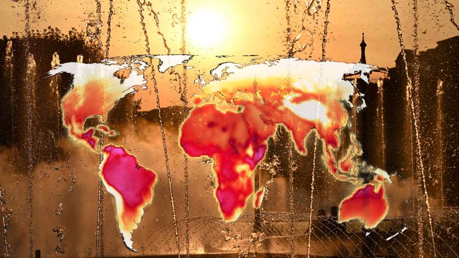
Climate projections suggest that rising global temperatures will increase the intensity of extreme weather conditions, such as droughts, hurricanes and heat waves. But when, where and how specifically these events will emerge is still uncertain.
To better predict future changes, scientists need to improve the accuracy of their weather and climate models, and for that they need data. One of the ways they get this data is through the Atmospheric Radiation Measurement User Facility (ARM), a multi-lab user facility of the US Department of Energy (DOE) Office of Science.
“One of SAIL’s scientific goals is to understand, from the top of Earth’s atmosphere to the bedrock of the Rocky Mountains, how moisture, precipitation and snowfall make their way through the atmosphere into the mountains. layers of rock and soil, then finally into the Colorado River. – Scott Collis, specialist in the atmosphere of Argonne
Scientists at DOE’s Argonne National Laboratory, as well as laboratories and universities across the country, are using ARM to obtain data to better represent climate-related processes in models on a global scale. Through two new field campaigns – Surface Atmosphere Integrated Field Laboratory (SAIL) and Tracking Aerosol Convection Interactions Experiment (TRACER) – Argonne researchers will work with multidisciplinary teams to collect data on key climate-related processes such as precipitation, cloud formation and aerosol interactions.
“This information will serve to improve our basic understanding of climate and will be used to improve the accuracy of climate and weather models and simulations,” said Scott Collis, atmospheric scientist at Argonne, co-investigator of the two campaigns.
Mountain watersheds provide 60-90% of the world’s water resources, but scientists still ignore much about the physical processes and interactions that affect hydrology in these ecosystems. (Video from the Lawrence Berkeley National Laboratory.)
Surface Atmosphere Integrated Field Laboratory (SAIL)
SAIL will deploy more than four dozen instruments in the East River watershed in Crested Butte, Colorado. The region includes portions of the Rocky Mountains and tributaries that flow into the Colorado River, which supports more than 40 million people.
Mountainous watersheds, like that of the East River, hold the majority of the world’s water supplies. Scientists need to learn much more about the impact of climate change on their future water supply to make models more accurate. To fill this gap, the SAIL campaign will focus on analyzing the entire water life cycle in the region.
“One of SAIL’s scientific goals is to understand, from the top of Earth’s atmosphere to the bedrock of the Rocky Mountains, how moisture, precipitation and snowfall make their way through the atmosphere into the mountains. layers of rock and soil and then eventually into the Colorado River, â€Collis said. In order to achieve this goal, SAIL will collocate the ARM atmospheric observations with the ongoing surface and subsurface hydrological observations of the DOE Watershed Function Science Focus Area (SFA) managed by Lawrence Berkeley National Laboratory (LBNL).
During the two-year campaign, scientists will analyze atmospheric processes and earth-atmosphere interactions that impact water supplies. These include such things as cloud formation, precipitation, snowfall or the interactions of precipitation with plants and roots, and the mechanics of groundwater transport.
“The fact that the campaign will integrate atmospheric, terrestrial and subterranean hydrology is what makes it unique,†​​said Ryan Sullivan, Argonne atmospheric scientist, SAIL co-investigator.
Tracking Aerosol Convection Interaction Experiment (TRACER)
Clouds play an important role in the Earth’s climate system. Thanks to the TRACER campaign, scientists will have the opportunity to study the impact of aerosols on their life cycle. Aerosols are liquid and solid particles small enough to be suspended in the air. The condensation of moisture on these particles contributes to the formation of clouds.
“The science of aerosols is still fairly recent. We have a lot to learn about the temperatures and physical conditions that make aerosols effective in influencing cloud formation, â€said Collis.
Aerosols can occur naturally or be generated by human activity, such as the combustion of petroleum and petroleum products. Knowing this, the scientists chose to campaign on the city of Houston, where industrial activities produce relatively high amounts of aerosols.
“We’re going to compare the evolution of clouds as they move inland,” said Bobby Jackson, deputy atmospheric scientist at Argonne, campaign co-investigator TRACE. “What we’re going to do in Houston is watch the clouds forming over the Gulf of Mexico. As they enter the Houston area, they will go from a cleaner air mass to a more polluted air mass.
To collect the data, scientists will deploy two mobile ARM facilities – equipped with instruments for measuring clouds, precipitation, aerosols and atmospheric states – around the city of Houston. The information they collect will, among other things, improve the way aerosols are represented in weather and climate models.
“Improving climate models through ARM observations will give decision makers more useful and accurate information about our current and future climate, which they can use to plan for the future,†said Collis.
[ad_2]